Connecting Our Streets: The Future of Active Travel in Dennistoun and the East End
A major transformation is on the horizon for the streets of Glasgow's East End, bringing a mix of promising infrastructure developments and notable logistical challenges to our local communities. Glasgow City Council has unveiled its refreshed active travel delivery framework, titled Connecting Glasgow. This updated strategy combines the City Network and Liveable Neighbourhoods programmes into a unified plan designed to fast-track safer walking, wheeling, and cycling routes across the city.
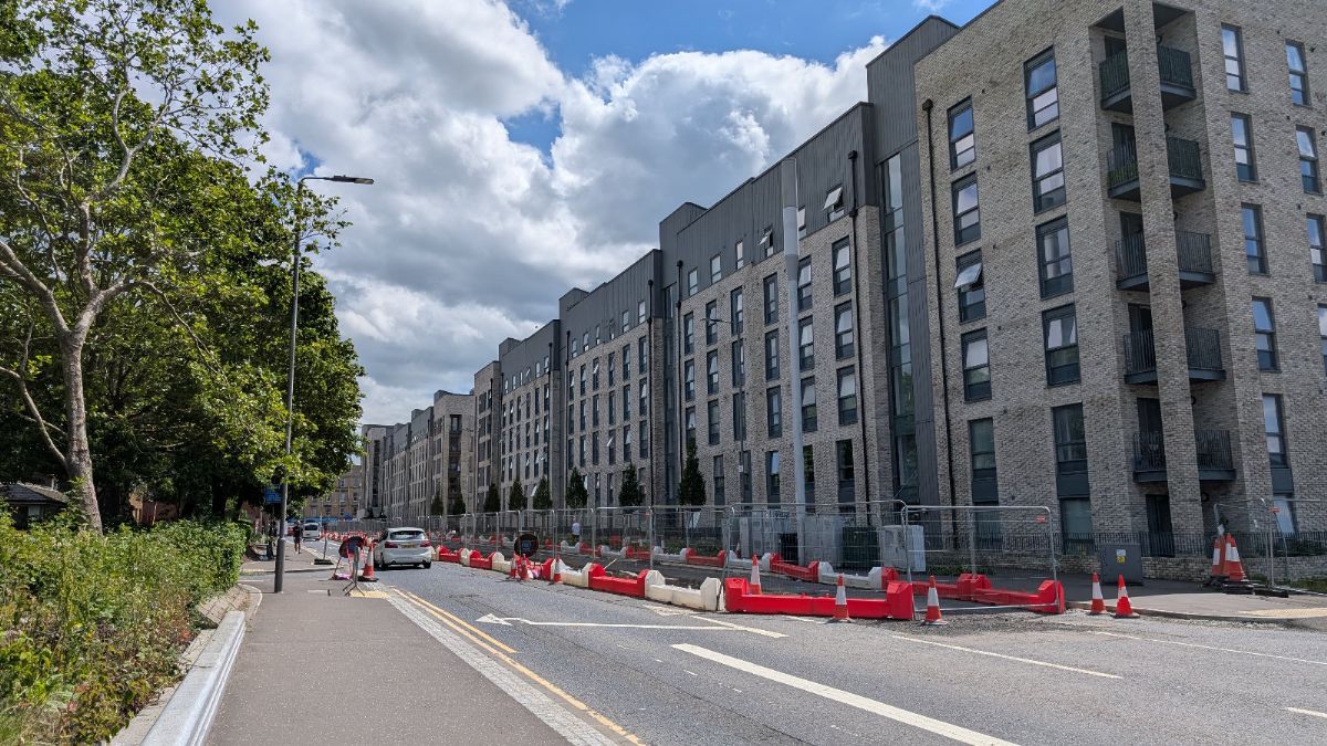
For those of us living and working among the historic blonde and red sandstone tenements of Dennistoun and the surrounding districts, this means significant infrastructure changes on our most familiar thoroughfares. However, this strategy arrives alongside a shifting financial landscape in how major urban projects are funded and delivered, presenting a more complex, long-term picture for our neighbourhoods.
The Funding Shift and the Scaled-Back Timeline
While the city initially set an ambitious target to construct a 270-kilometre citywide network of safe, segregated routes by 2031, major funding hurdles have altered the immediate scope of the rollout. Transport Scotland has transitioned from a stable, multi-year funding model to competitive, single-year allocations through the Active Travel Infrastructure Fund. Because of the financial uncertainty created by this shift, the council has focused its immediate delivery framework on a scaled-back priority network of 54.44 kilometres citywide by 2032, heavily prioritizing an inner orbital loop and primary radial corridors to prevent our area from becoming an isolated infrastructure island.
For local residents, this deliverability-first focus creates a mixed reality. While vital local arteries are included in the immediate shorter-term priority list, other local connections are being pushed back. Any remaining routes in and around the Dennistoun area that did not make this strict cut are now deferred to a review in 2027 or 2028 simply to identify a suitable delivery approach, meaning a comprehensive web of safe local paths will be a gradual, piecemeal rollout over the coming decade.
Transforming Our Key Local Corridors
The Connecting Glasgow plan highlights a series of essential transformations for the main arteries that feed into our local communities. Duke Street and Alexandra Parade have long served as the vibrant backbones of Dennistoun's commercial and social life, transitioning from our proud industrial past into the bustling independent high streets we enjoy today. Under the new proposals, these corridors will see direct integration with the city's wider network.
Alexandra Parade is set to receive a dedicated 1.8-kilometre spoke route, aiming to create a safer environment for everyday journeys past our local shops, businesses, and residential avenues. Further south, the Duke Street East section stretching towards Shettleston is earmarked for a substantial 2.3-kilometre dedicated spoke route. This development aims to provide a safe, protected route for residents commuting cityward or traveling locally, making it easier to opt for two wheels instead of four. Nearby, Bellgrove and Abercromby Street will see a 0.9-kilometre connection, bridging the gap between Dennistoun and Calton to ensure our historic streets become more people-friendly spaces.
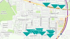
Our beloved Alexandra Park, a cherished local landmark and green sanctuary since the Victorian era, sits at the absolute centre of these orbital plans. Alexandra Park Street is set to feature a critical 5.6-kilometre section of the Proposed Orbital Route, forming a foundational component of the connected city core. Further north and east, the infrastructure expands to weave our surrounding communities tightly together. Viewpark Avenue will receive a 1.1-kilometre orbital upgrade, while Millerston Street adds a vital 0.5-kilometre link to keep the network continuous. For residents in Riddrie and Provanmill, the expansion of Cumbernauld Road by 1.5 kilometres offers a much-needed protected spoke route, while a 1.16-kilometre project along Edinburgh Road to Carntyne aims to break down traditional transport barriers and open up sustainable travel choices for local households.
East End Infrastructure Breakdown
To provide a clear overview of how these changes take shape across our local landscape, the specific allocations for the East End sections within the framework are outlined below.
| Proposed Route Section | Network Classification | Distance |
| Alexandra Park Street | Orbital Network | 5.6 kilometres |
| Duke Street (East) to Shettleston | Spoke Network | 2.3 kilometres |
| Alexandra Parade | Spoke Network | 1.8 kilometres |
| Cumbernauld Road to Provanmill | Spoke Network | 1.5 kilometres |
| Edinburgh Road to Carntyne | Spoke Network | 1.16 kilometres |
| Viewpark Avenue | Orbital Network | 1.1 kilometres |
| Bellgrove and Abercromby Street | Spoke Network | 0.9 kilometres |
| Wishart Street | Spoke Network | 0.62 kilometres |
| Millerston Street | Orbital Network | 0.5 kilometres |
The unique edges of our neighbourhood will also see targeted adjustments. Wishart Street, which traces the historic path past the Glasgow Necropolis and the cathedral, is scheduled for a 0.62-kilometre dedicated spoke route, blending the preservation of our architectural past with modern sustainable transport solutions.
Balancing Benefits with Construction Disruption
Recent data shows an appetite for sustainable transport, with citywide cycle trips growing by 43 percent in 2025 compared to the previous year, and a clear majority of Glasgow residents supporting a shift in investment toward public transport and walking. However, the operational side effects of building these new layouts present immediate, real-world downsides for the daily life of local residents.
Because projects must now be funded via competitive, single-year bids, there is a significantly increased risk of projects stalling between design and construction stages if funding is not secured in consecutive financial years. This can lead to a fragmented, stop-start streetscape, meaning roads and pavements could be dug up and left at a standstill for months if there is a gap in the annual funding cycle. Instead of a swift rollout, residents face prolonged local traffic disruption, temporary traffic lights, and ongoing disruption right outside their tenement doors.
Furthermore, because construction will simultaneously target multiple major arteries in the same geographic pocket, traffic congestion on key diversion routes will inevitably spike. If Duke Street and Alexandra Parade undergo concurrent lane closures, vehicle capacity will be temporarily reduced, creating severe bottlenecks for commuters and local buses. This gridlock on main thoroughfares may force frustrated drivers to cut through narrow, residential grid-pattern streets in Dennistoun, compromising local peace.
Parking is already a premium commodity among Dennistoun's dense tenement blocks. During the construction phase, significant stretches of on-street parking will be temporarily suspended to accommodate machinery, materials storage, and the widening of footways. This will inevitably displace hundreds of residents' cars at a time, forcing them deeper into surrounding residential zones and escalating parking friction across the neighbourhood. Additionally, the pressure to meet tight annual funding windows forces accelerated construction cycles, which drastically cuts the time available for thorough community engagement and risks causing consultation fatigue among residents who feel their feedback cannot be fully accommodated.
Community Perspectives and Long-Term Maintenance
Active travel infrastructure remains a heavily debated topic across Glasgow, drawing intense friction when abstract plans become physical realities. A major grievance for local businesses on high streets like Duke Street or Alexandra Parade involves the potential removal of on-street parking and delivery loading bays to clear a path for segregated tracks. In council consultations for similar high-street schemes across the city, such as Saracen Street, up to 77 percent of local respondents strongly rejected the layouts, citing a clear preference for preserving space for local commerce, business loading, and bus lanes over dedicated cycle paths. Independent retailers frequently express concern that prolonged construction closures suppress footfall, while permanent parking restrictions discourage shoppers from visiting the area.
There is also a broader discussion regarding geographical and economic inequalities in how resources are distributed. Data from Glasgow City Council reveals massive demographic gaps in active travel participation, showing that 68 percent of bike riders in the city are men, 92 percent are white, and half are under the age of 34. This leaves women, older demographics, and ethnic minorities heavily underrepresented, raising questions about how inclusive these new networks truly are in their current form.
Finally, maintenance and design execution remain vital points of criticism. Completed paths frequently suffer from potholes, broken lights, and uncleared road detritus such as leaves and broken glass. Poor surface water drainage regularly causes localized flooding across paths, and during winter months, these segregated tracks are rarely prioritized for gritting to the same extent as main vehicle lanes, occasionally turning them into ice rinks. Local housing associations and community organizations will need to play an active, vigilant role in ensuring that these physical changes are properly maintained and that the original, holistic Liveable Neighbourhood ambitions, such as street-greening and safer crossings, are not stripped away in favor of basic, cost-reduced cycle lanes.